







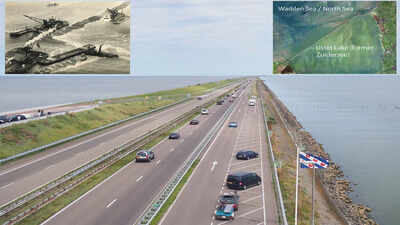
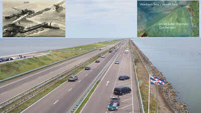
People live on land that was once part of the ocean floor. This is part of daily life for thousands of people in central Netherlands. The Dutch have long managed flooding from the rising waters of the North Sea.For centuries, the Zuiderzee cut into the heart of the country, serving as both a maritime route and a threat to nearby coastal communities. Ships from all over Europe sailed across these waves, carrying wealth and goods to thriving trading hubs. However, the relentless danger of devastating floods eventually forced the nation to make a bold decision. They chose to tame the sea by constructing the 32-kilometre Afsluitdijk dam.To understand how this engineering feat transformed the region, researchers examined the soil closely. A study published in the International Journal of Nautical Archaeology sheds new light on this radical geographic evolution. Written by maritime archaeologist Yftinus van Popta, the research explores how an area that transitioned from medieval peatlands into a salty tidal lagoon was ultimately reclaimed by modern engineering. The project shows that draining the inland sea to create farmland led to Flevoland, a new province with centuries of maritime history beneath its soil.According to the paper, the transformation of the area from peatland with freshwater basins to tidal lagoons was brought about mainly by land farming, flooding, and rising sea levels, resulting in many settlements being inundated and vast stretches submerged. The study centres on the period from AD 1100-1400 and uses a multi-disciplinary approach to combine historical, geological, geographical, and maritime archaeological records to recreate the forgotten landscape.A museum under the soilThe province’s emergence is notable in both history and archaeology. With the draining of water and drying up of the bed of the sea, a pristine time capsule of the past was revealed. Instead of searching underwater, archaeologists were walking muddy fields to recover vessels.The Noordoostpolder, a major part of the reclaimed province, turned out to be one of the world’s largest ship graveyards. Hundreds of vessels, ranging from medieval cargo boats to grand trading ships from the Dutch Golden Age, were found packed tightly into the soil. These ships had originally sunk during sudden, violent storms on the unpredictable Zuiderzee, settling into the soft, protective mud of the seabed. When the modern dam pushed the sea back, it effectively froze these historical treasures in time.In recent times, the farmers working in the fields may encounter an ancient surprise. While ploughing a field of potatoes or tulips, a farmer may uncover timbers from an ancient shipwreck. A shipwreck in a field is a reminder of how closely the past and present are linked.
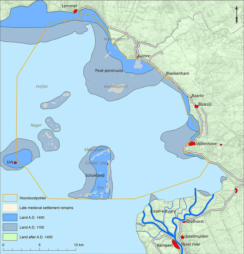
Medieval villages and their structures also lay hidden beneath the modern fields. Researchers used multiple disciplines to reconstruct this forgotten landscape. Living on this reclaimed land showcases human ingenuity and a cycle of loss. Image Credits: Figure 4 .Maritime Culture in the Netherlands: accessing the late medieval maritime cultural landscapes of the north‐eastern Zuiderzee
Medieval villages under the reclaimed landShips are only one part of the researchers’ findings. According to the researchers, before the era of large ships, the area had a very different look. From the twelfth until the fourteenth century, the area was an unprotected system of freshwater lakes and swamps populated by small farming villages. With rising sea levels and storm floods breaking the natural barriers of the coast, the water gradually swallowed the land, leaving behind ruined villages.Using geological data, old maps and soil analysis, the researchers traced the outlines of these lost medieval communities. The modern fields of Flevoland cover not only old fishing grounds but also the farms, churches and paths of people who lived centuries ago. That insight has helped historians better understand the Netherlands’ cultural landscape and its long cycle of loss and reclamation.Living on land reclaimed from the sea is a testament to human ingenuity. The flat farmland now cultivated here was once under the sea, home to ships, fishermen, and marine life. The Afsluitdijk was built to protect the Dutch from flooding.