, Ether (ETH) suffer worst weekly drop since FTX crash")


Precipitation types are differentiated in forecasts to give a better understanding of what weather to expect.
The frozen forms are self-explanatory, like snow or hail, but it is liquid drops which create the most confusion.
Firstly, the definition of drizzle is not related to the intensity of precipitation.
More precisely, drizzle is the technical term for extremely small water droplets less than half a millimetre in diameter.
Then comes the rain-showers conundrum, and the difference between the two refers to duration and extent, and not intensity or more specifically the type of cloud the droplets spawned in.
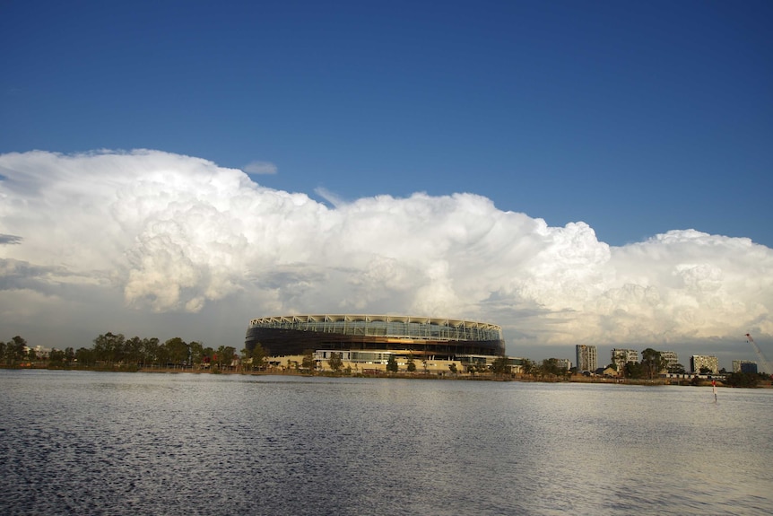
Showers fall from cumuliform clouds. (ABC News: Andrew O’Connor)
Showers fall from cumuliform clouds; the puffy looking clouds which are often separated by blue sky.
Cumuliform clouds often bring no rain or only a brief light shower, but when they grow into towering cumulus congestus or cumulonimbus (thunderstorms), precipitation can be torrential.
And when heavy showers and thunderstorms are frequent, 100 millimetres or more could fall in a day, but it is still classified as showers as long as precipitation does not simultaneously engulf an entire region.
Rain on the other hand normally falls from stratiform cloud, which is when the entire sky is overcast and precipitation is falling over a broad region.
But rain, like showers, can range from just a drop or two, through light, moderate, grading to heavy or torrential. It all depends on the weather system at play.