The US meteorological agency has declared an El Niño has now formed in the Pacific Ocean and warned it could reach record-breaking intensity in coming months.
The National Oceanic and Atmospheric Administration (NOAA) officially confirmed the existence of the El Niño, which is a warming of the Pacific near the equator that affects weather patterns across the globe.
NOAA’s announcement said there’s a 63 per cent chance that the El Niño will get so intense over the Southern Hemisphere’s spring and early summer that it “would rank among the largest El Niño events in the historical record going back to 1950.”
Experts said the El Niño, a natural warming cycle, should further heat a globe already warming from fossil fuel pollution and will likely turbocharge extreme weather across the planet.
Meteorologists forecast it will rival — or exceed — a record El Niño that began in 1997 and helped trigger billions of dollars in damage from heat waves, floods, droughts, tornadoes and wildfires.
Clark University climate scientist Abby Frazier said the warm, deep waters of an El Niño affect weather patterns by bringing “a lot of extra heat to the surface, fueling a lot of extreme events for a lot of places around the world”.
She said, especially in the Pacific, that “it can get dire very quickly”.
United Nations Secretary-General António Guterres described El Niño as an “urgent climate warning.”
“El Niño conditions will pour fuel on the fire of a warming world,” Mr Guterres said in a video message.
Forecasters use a region of the Pacific Ocean to determine whether an El Niño or La Niña is underway. (Supplied: NOAA)
What an El Niño will mean
The weather pattern’s effects vary by region. El Niño often dampens — but does not eliminate — Atlantic hurricane season activity, but increases the chance of cyclones and typhoons in the Pacific.
In Australia, the climate driver can intensify drought, bushfires and heatwaves.
So while the US East and Gulf coasts may get a break, Hawaii and other islands are more in danger, Ms Frazier said.
The drought-stricken Middle East could benefit, climate scientists said. Other places are looking at more danger.
Parts of western South America — where the first El Niños were noticed decades ago — often get heavy rain and floods, along with an extra warm summer.
India faces more intense heat waves, and has already experienced 45 degree Celsius days this month.
Columbia University climate scientist and El Niño expert Muhammad Azhar Ehsan said north-eastern Africa is likely going to get weather whiplash from intense drought to dangerously heavy rains.
In the US, El Niños can cause more intense storms with heavier rainfall in the South, but they also tend to generally benefit the US agriculture industry, said Jon Gottschalck, operational branch chief at NOAA’s Climate Prediction Center.
Michael Ferrari, meteorologist and head of research at the investment research firm Moby, said conditions for grains and seed, especially soybeans, look favourable in 18 major growing states, but are more mixed when it comes to dairy and cattle.
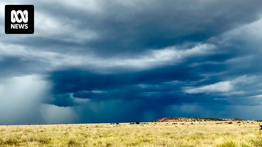
There is a 63 per cent chance this El Niño could be one of the strongest on record. (AAP: Mick Tsikas)
The northern Rockies and Southwest — where there’s an “off the charts” snow drought — could get some strong summer rains, Mr Gottschalck said.
The biggest effect in the US is often in the winter, when the south can get wetter and the Pacific Northwest warmer and drier.
But overall, temperatures raised by the weather pattern can dampen American economic growth, said Stanford climate economist Marshall Burke.
Several climate scientists forecast that 2027 will be the hottest year on record because of lagging effects of this El Niño, which is expected to peak in the fall or winter.
“We have pretty clear evidence that the US economy grows more slowly when temps are above normal,” Mr Burke said.
Strong early signs
The weather extremes caused by an El Niño also depend on when it develops.
Usually El Niños form in the Northern Hemisphere’s summer, peak in the late fall or early winter, and peter out the next spring, scientists said.
However, Mr Ehsan’s team forecasts that this El Niño will peak a month or two earlier based on strong early signs from recent weeks.
Princeton University climate scientist Gabriel Vecchi said large El Niños like these also tend to last longer.
The early indications — including warmer water pushing toward the surface of the Pacific — have been so strong and noticeable that forecasters have all been predicting the same ultra strong El Niño, Dr Vecchi said, adding that El Niño forecasts often are all over the place at this time of year.
Scientists predict stronger El Niños as the world warms from the burning of coal, oil and gas, Ms Frazier and others said. But she said it is too early to say if this El Niño is part of that.
Even before it officially formed, this El Niño has gotten nicknames ranging from “super” to “Godzilla.”
“Instead of scared, we can ask people to be prepared,” Mr Ehsan said.